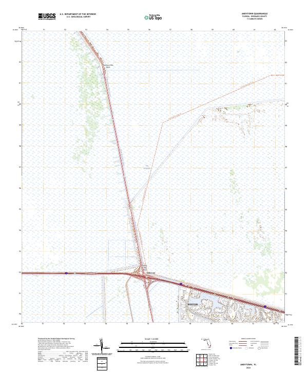
2024 Map of Andytown
USGS Topo · Published 2024About this map
The Everglades dominates this 2024 landscape, showcasing the extensive water management systems that define the Broward County interior. The North New River Canal cuts a sharp diagonal across the marshy terrain, punctuated by distinct landmarks such as Twentysix Mile Bend and Twenty- Mile Bend. These features reflect the long history of drainage and reclamation efforts in South Florida, where artificial waterways and levees created the conditions for inland expansion.
Find a feature on this map
37 named features on this map. Tap any name to fly to it.
Don’t see what you’re looking for? This feature index may not catch every label — zoom into the map to look around manually.
Map Details
Editions of this 2024 Andytown Map
This is the sole edition of this map. No revisions or reprints were ever made.
Other maps of this area

1956 · West Palm Beach
USGS Topo · 1:250,000

1957 · West Palm Beach
USGS Topo · 1:250,000

1958 · West Palm Beach
USGS Topo · 1:250,000

1963 · Andytown
USGS Topo · 1:24,000

1963 · Cooper City SW
USGS Topo · 1:24,000

1963 · Fort Lauderdale 2 SE
USGS Topo · 1:24,000
1963 · Cooper City NE
USGS Topo · 1:24,000
1963 · Cooper City
USGS Topo · 1:24,000

1973 · Everglades 4 NE
USGS Topo · 1:24,000

1973 · Everglades 4 SE
USGS Topo · 1:24,000