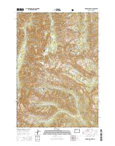
2014 Map of Aneroid Mountain
USGS Topo · Published 2014About this map
Wallowa National Forest defines this high-elevation landscape, where the peaks and ridges of the Wallowa Mountains dictate the flow of several major drainage systems. Aneroid Mountain and Bonneville Mountain stand as dominant landmarks, surrounded by a high-basin environment that includes McCully Basin and Big Sheep Basin. The map captures a complex network of alpine lakes, notably Aneroid Lake and the Bonny Lakes, which feed the headwaters of the North Fork Imnaha River and the West Fork Wallowa River. Historically significant for recreation and conservation, this terrain features several high passes and meadows, such as Tenderfoot Pass and Six Mile Meadow, illustrating the natural corridors used to navigate the wilderness. The surveyor's detail reveals the source points for multiple forks of the Middle Fork Imnaha River, showing how the Imnaha Divide separates these water systems.
Find a feature on this map
31 named features on this map. Tap any name to fly to it.
Don’t see what you’re looking for? This feature index may not catch every label — zoom into the map to look around manually.
Map Details
Editions of this 2014 Aneroid Mountain Map
This is the sole edition of this map. No revisions or reprints were ever made.
Other maps of this area

1954 · Cornucopia
USGS Topo · 1:62,500

1954 · Eagle Cap
USGS Topo · 1:62,500

1955 · Grangeville
USGS Topo · 1:250,000

1957 · Enterprise
USGS Topo · 1:62,500

1957 · Joseph
USGS Topo · 1:62,500

1959 · Grangeville
USGS Topo · 1:250,000

1986 · Enterprise
USGS Topo · 1:100,000
1990 · Krag Peak
USGS Topo · 1:24,000
1990 · Deadman Point
USGS Topo · 1:24,000

1990 · Chief Joseph Mtn
USGS Topo · 1:24,000