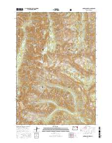
2017 Map of Aneroid Mountain
USGS Topo · Published 2017About this map
Wallowa National Forest serves as the backdrop for this high-altitude landscape, where the headwaters of several major drainages originate. The terrain is defined by prominent peaks including Aneroid Mountain, Bonneville Mtn, and Petes Point, which overlook a network of glacial lakes and basins. The hydrology of the area is particularly complex, as the map records the diverging paths of the E Fork Wallowa River, the N Fork Imnaha River, and the Middle Fork Big Sheep Cr. These watercourses flow from high-elevation catchments like Aneroid Lake and Bonny Lakes. Evidence of the region's surveying history is preserved through numerous cadastral markings and the Imnaha Divide, while recreational and geographical landmarks such as Tenderfoot Pass and Six Mile Meadow provide specific points of orientation within this protected forest land.
Find a feature on this map
44 named features on this map. Tap any name to fly to it.
Don’t see what you’re looking for? This feature index may not catch every label — zoom into the map to look around manually.
Map Details
Editions of this 2017 Aneroid Mountain Map
This is the sole edition of this map. No revisions or reprints were ever made.
Other maps of this area

1954 · Cornucopia
USGS Topo · 1:62,500

1954 · Eagle Cap
USGS Topo · 1:62,500

1955 · Grangeville
USGS Topo · 1:250,000

1957 · Enterprise
USGS Topo · 1:62,500

1957 · Joseph
USGS Topo · 1:62,500

1959 · Grangeville
USGS Topo · 1:250,000

1986 · Enterprise
USGS Topo · 1:100,000
1990 · Krag Peak
USGS Topo · 1:24,000
1990 · Deadman Point
USGS Topo · 1:24,000

1990 · Chief Joseph Mtn
USGS Topo · 1:24,000