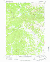
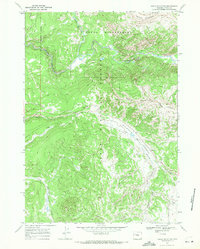
1965 Map of Angle Mountain
USGS Topo · Published 1972About this map
Togwotee Lodge serves as a primary human outpost in this high-altitude landscape where the Teton National Forest meets the protected boundary of the Teton Wilderness. The map reveals a complex drainage system where the North Buffalo Fork and South Buffalo Fork converge into the Buffalo Fork, a pattern that defines the movement of water and travelers through the region. Historical movement is etched into the terrain through a network of trails, including the Two Ocean-North Buffalo Trail and the high-elevation crossing at Bear Cub Pass. In the southern reaches, the wide expanse of Blackrock Meadows sits below the prominent summit of Angle Mountain, while smaller waterways like North Fork Spread Creek and Flagstaff Creek carve through the heavily forested slopes. A small Gravel Pit near Blackrock Creek provides a rare trace of industrial utility within this largely undeveloped mountain environment.
Find a feature on this map
22 named features on this map. Tap any name to fly to it.
Don’t see what you’re looking for? This feature index may not catch every label — zoom into the map to look around manually.
Map Details
Editions of this 1965 Angle Mountain Map
3 editions found
Other maps of this area

1902 · Mt Leidy
USGS Topo · 1:125,000

1955 · Driggs
USGS Topo · 1:250,000

1958 · Driggs
USGS Topo · 1:250,000

1962 · Driggs
USGS Topo · 1:250,000

1965 · Green Mountain
USGS Topo · 1:24,000
1965 · Lava Mountain
USGS Topo · 1:24,000

1965 · Rosies Ridge
USGS Topo · 1:24,000

1965 · Tripod Peak
USGS Topo · 1:24,000
1965 · Togwotee Pass
USGS Topo · 1:24,000
1965 · Angle Mountain
USGS Topo · 1:24,000