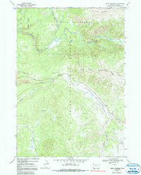
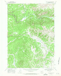
1965 Map of Angle Mountain
USGS Topo · Published 1991About this map
Togwotee Lodge serves as a lone human waypoint in this high-altitude landscape of the mid-1960s, situated along the road corridor between Blackrock Creek and the surrounding peaks. The map reveals an intricate network of pack trails, including the North Buffalo Trail (Pack), which provided essential access through the Teton Wilderness and Teton National Forest long before modern development. These routes follow the natural drainages of the North Buffalo Fork and South Buffalo Fork, converging near Bear Cub Pass. The topography is dominated by the massive presence of Angle Mountain and Terrace Mountain, while lower elevations like Blackrock Meadows show the intersection of natural waterways and early 20th-century resource use, evidenced by a lone Gravel Pit. The map captures the watershed where Grizzly Creek, Flagstaff Creek, and the North Fork Spread Creek carve through the high country.
Find a feature on this map
21 named features on this map. Tap any name to fly to it.
Don’t see what you’re looking for? This feature index may not catch every label — zoom into the map to look around manually.
Map Details
Editions of this 1965 Angle Mountain Map
3 editions found
Other maps of this area

1902 · Mt Leidy
USGS Topo · 1:125,000

1955 · Driggs
USGS Topo · 1:250,000

1958 · Driggs
USGS Topo · 1:250,000

1962 · Driggs
USGS Topo · 1:250,000

1965 · Green Mountain
USGS Topo · 1:24,000
1965 · Lava Mountain
USGS Topo · 1:24,000

1965 · Rosies Ridge
USGS Topo · 1:24,000

1965 · Tripod Peak
USGS Topo · 1:24,000
1965 · Togwotee Pass
USGS Topo · 1:24,000
1965 · Angle Mountain
USGS Topo · 1:24,000