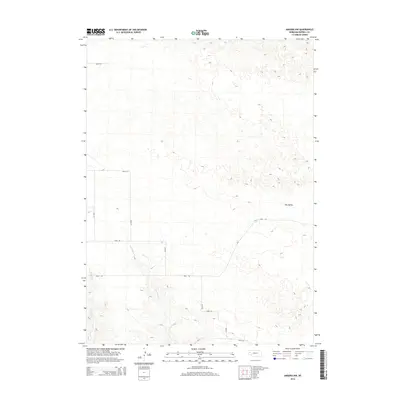
2014 Map of Angora NW
USGS Topo · Published 2014About this map
Hay Valley characterizes the northeastern landscape of this Morrill County region, where the terrain transitions into the subtle drainage basins of Red Willow Cr and W Water Cr. This 2014 survey by the U.S. Geological Survey illustrates a sparsely populated agricultural or ranching area defined by a strict section-line road network. The layout of Road 138, Road 132, and Road 126 suggests a systematic approach to land management in the Nebraska Panhandle, providing essential access for local operations. The map is particularly useful for identifying the precise coordinates of local watercourses and topographical depressions in an area where small shifts in elevation dictate the natural flow towards the creek beds.
Find a feature on this map
15 named features on this map. Tap any name to fly to it.
Don’t see what you’re looking for? This feature index may not catch every label — zoom into the map to look around manually.
Map Details
Editions of this 2014 Angora NW Map
This is the sole edition of this map. No revisions or reprints were ever made.
Other maps of this area

1898 · Camp Clarke
USGS Topo · 1:125,000

1948 · Hemingford 4 SW
USGS Topo · 1:24,000

1948 · Hemingford 4 SE
USGS Topo · 1:24,000

1951 · Kilpatrick Lake
USGS Topo · 1:62,500

1954 · Scottsbluff
USGS Topo · 1:250,000

1955 · Alliance
USGS Topo · 1:250,000

1957 · Alliance
USGS Topo · 1:250,000

1958 · Alliance
USGS Topo · 1:250,000

1958 · Scottsbluff
USGS Topo · 1:250,000

1965 · Bayard
USGS Topo · 1:24,000