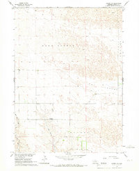
1965 Map of Angora NW
USGS Topo · Published 1967About this map
Good Streak and Hay Valley define the open, rolling terrain of this section of the Nebraska Panhandle in the mid-1960s. The landscape is characterized by its intermittent drainage systems and expansive grazing lands, typical of the high plains environment. Scattered landmarks like School No 42 provide evidence of the rural community structure that persisted in this region during the 1965 field check. Water remains the primary shaper of the landscape and local economy, with the courses of West Water Creek and Red Willow Creek carving through the prairie. This survey, part of the Department of the Interior program for the development of the Missouri River Basin, highlights the sparse but essential infrastructure of Morrill Co and its boundary with Banner County. The presence of a solitary Well near the valley floor further underscores the reliance on localized groundwater in this arid Nebraska landscape.
Find a feature on this map
9 named features on this map. Tap any name to fly to it.
Don’t see what you’re looking for? This feature index may not catch every label — zoom into the map to look around manually.
Map Details
Editions of this 1965 Angora NW Map
This is the sole edition of this map. No revisions or reprints were ever made.
Other maps of this area

1898 · Camp Clarke
USGS Topo · 1:125,000

1948 · Hemingford 4 SW
USGS Topo · 1:24,000

1948 · Hemingford 4 SE
USGS Topo · 1:24,000

1951 · Kilpatrick Lake
USGS Topo · 1:62,500

1954 · Scottsbluff
USGS Topo · 1:250,000

1955 · Alliance
USGS Topo · 1:250,000

1957 · Alliance
USGS Topo · 1:250,000

1958 · Alliance
USGS Topo · 1:250,000

1958 · Scottsbluff
USGS Topo · 1:250,000

1965 · Bayard
USGS Topo · 1:24,000