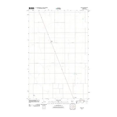
2010 Map of Angus
USGS Topo · Published 2010About this map
Angus serves as the central point of this Red River Valley agricultural landscape, situated at a major diagonal road junction in Polk County. The terrain is defined by a precise rectilinear grid of section roads and drainage patterns, characteristic of the expansive farming operations in Northwest Minnesota. Local genealogy and history are anchored by two distinct burial sites located at opposite ends of the quadrangle: Saint Pauls Cemetery in the southwest and Prairie View Cemetery in the southeast. A network of secondary routes like County Hwy-67 and 140th St NW connects the dispersed farmsteads to the primary transit corridor, while seasonal waterways meander across the flat prairie soil, illustrating the sophisticated water management required for regional cultivation.
Find a feature on this map
13 named features on this map. Tap any name to fly to it.
Don’t see what you’re looking for? This feature index may not catch every label — zoom into the map to look around manually.
Map Details
Editions of this 2010 Angus Map
This is the sole edition of this map. No revisions or reprints were ever made.
Other maps of this area

1918 · Angus
USGS Topo · 1:62,500

1918 · Warren
USGS Topo · 1:62,500

1952 · Grand Forks
USGS Topo · 1:250,000

1952 · Thief River Falls
USGS Topo · 1:250,000

1953 · Crookston
USGS Topo · 1:62,500

1955 · Warren
USGS Topo · 1:62,500

1956 · Thief River Falls
USGS Topo · 1:250,000

1956 · Grand Forks
USGS Topo · 1:250,000

1957 · Thief River Falls
USGS Topo · 1:250,000

1961 · Radium
USGS Topo · 1:24,000