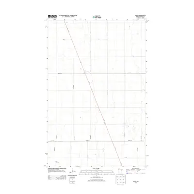
2013 Map of Angus
USGS Topo · Published 2013About this map
Angus sits as a central junction within the wide agricultural reaches of Polk County, where the diagonal line of Us-75 cuts across the cardinal grid of rural township roads. This landscape is defined by the rigid geometry of the public land survey system, evidenced by the numbered section lines of 290th Ave NW and 300th Ave NW. In the southwestern corner, Saint Pauls Cem provides a local genealogical anchor, serving the scattered farmstead community. While many rural areas have seen their centers shift over decades, the persistence of the settlement at Angus and the maintaining of the surrounding road network, including Field Rd and Center St W, reflect the long-standing stability of this Minnesota farming region in the early 21st century.
Find a feature on this map
17 named features on this map. Tap any name to fly to it.
Don’t see what you’re looking for? This feature index may not catch every label — zoom into the map to look around manually.
Map Details
Editions of this 2013 Angus Map
This is the sole edition of this map. No revisions or reprints were ever made.
Other maps of this area

1918 · Angus
USGS Topo · 1:62,500

1918 · Warren
USGS Topo · 1:62,500

1952 · Grand Forks
USGS Topo · 1:250,000

1952 · Thief River Falls
USGS Topo · 1:250,000

1953 · Crookston
USGS Topo · 1:62,500

1955 · Warren
USGS Topo · 1:62,500

1956 · Thief River Falls
USGS Topo · 1:250,000

1956 · Grand Forks
USGS Topo · 1:250,000

1957 · Thief River Falls
USGS Topo · 1:250,000

1961 · Radium
USGS Topo · 1:24,000