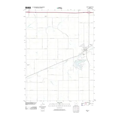
2010 Map of Anita
USGS Topo · Published 2010About this map
Anita serves as the central hub of this Cass County landscape, where the confluence of several vital waterways shapes the local geography. The town is situated along Turkey Creek, which flows westward past the Anita Municipal Airport. The rural surrounding territory is organized by an orderly grid of roads, many bearing regional names like Boston Rd, Chicago Rd, and Dallas Rd. To the north, the winding paths of Troublesome Creek and Crooked Creek contrast with the straight lines of the agricultural parcels. Genealogists and local historians can find three distinct burial sites on this sheet: Evergreen Cemetery on the northeastern edge of town, Highland Cemetery to the north, and Saint Josephs Cemetery situated to the west, providing a clear record of the community's early settlement clusters and family heritage.
Find a feature on this map
23 named features on this map. Tap any name to fly to it.
Don’t see what you’re looking for? This feature index may not catch every label — zoom into the map to look around manually.
Map Details
Editions of this 2010 Anita Map
This is the sole edition of this map. No revisions or reprints were ever made.
Other maps of this area

1954 · Omaha
USGS Topo · 1:250,000

1957 · Omaha
USGS Topo · 1:250,000

1957 · Audubon
USGS Topo · 1:62,500

1958 · Omaha
USGS Topo · 1:250,000

1971 · Adair South
USGS Topo · 1:24,000

1971 · Anita
USGS Topo · 1:24,000

1971 · Wiota
USGS Topo · 1:24,000

1971 · Anita SW
USGS Topo · 1:24,000

1971 · Massena
USGS Topo · 1:24,000

1971 · Fontanelle SW
USGS Topo · 1:24,000