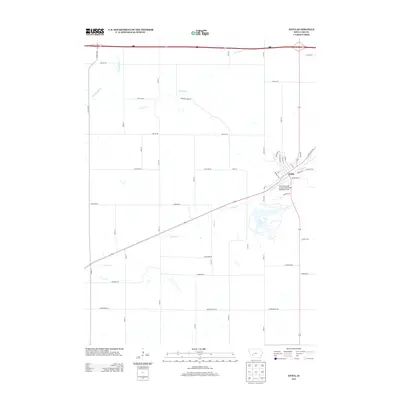
2013 Map of Anita
USGS Topo · Published 2013About this map
The town of Anita serves as the focal point of this southwestern Iowa landscape, situated where the historic White Pole RD intersects with modern transit corridors. This 2013 survey captures a rural environment defined by a grid of agricultural section roads, such as Dallas Rd and Independence Rd, which bridge the numerous waterways draining the region. To the south of the town center, Lake Anita provides a significant recreational footprint, while the Anita Municipal Airport-Kevin Burke Memorial Field stands just to the east. The terrain is deeply etched by a network of drainage systems, including Troublesome Cr in the northwest and Turkey Cr, which flows directly through the settlement. This map documents the persistent agricultural character of Cass County, showing how the local road network—including legacy routes like Agency Ln—continues to adapt around these persistent natural features.
Find a feature on this map
44 named features on this map. Tap any name to fly to it.
Don’t see what you’re looking for? This feature index may not catch every label — zoom into the map to look around manually.
Map Details
Editions of this 2013 Anita Map
This is the sole edition of this map. No revisions or reprints were ever made.
Other maps of this area

1954 · Omaha
USGS Topo · 1:250,000

1957 · Omaha
USGS Topo · 1:250,000

1957 · Audubon
USGS Topo · 1:62,500

1958 · Omaha
USGS Topo · 1:250,000

1971 · Adair South
USGS Topo · 1:24,000

1971 · Anita
USGS Topo · 1:24,000

1971 · Wiota
USGS Topo · 1:24,000

1971 · Anita SW
USGS Topo · 1:24,000

1971 · Massena
USGS Topo · 1:24,000

1971 · Fontanelle SW
USGS Topo · 1:24,000