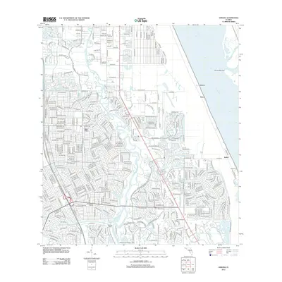
2012 Map of Ankona
USGS Topo · Published 2012About this map
The N Fork Saint Lucie River and its various tributaries like Long Cr define the western landscape of this coastal Florida quadrangle, where residential developments transition into protected natural areas. At the southern bend of the river, Spruce Bluff stands as a prominent landmark near Mud Cove and Kitching Cove. This 2012 survey illustrates the dense suburban grid of River Park and the specialized infrastructure of the Kitching Cove Seaplane Base.
Find a feature on this map
403 named features on this map. Tap any name to fly to it.
Don’t see what you’re looking for? This feature index may not catch every label — zoom into the map to look around manually.
Map Details
Editions of this 2012 Ankona Map
This is the sole edition of this map. No revisions or reprints were ever made.
Other maps of this area

1948 · Palm City
USGS Topo · 1:24,000

1948 · Ankona
USGS Topo · 1:24,000

1948 · St. Lucie Inlet
USGS Topo · 1:24,000

1948 · Eden
USGS Topo · 1:24,000

1949 · Fort Pierce
USGS Topo · 1:24,000

1949 · Fort Pierce NW
USGS Topo · 1:24,000

1950 · St. Lucie Inlet
USGS Topo · 1:24,000

1950 · Ankona
USGS Topo · 1:24,000

1950 · Fort Pierce
USGS Topo · 1:24,000

1950 · Palm City
USGS Topo · 1:24,000