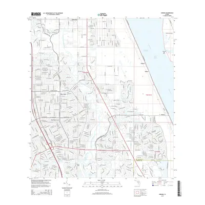
2015 Map of Ankona
USGS Topo · Published 2015About this map
Port Saint Lucie and its neighboring residential communities dominate this mid-2010s coastal landscape, where dense suburban expansion meets the ecological complexity of the Treasure Coast. The map documents the intricate waterway system defining the region, from the winding North Fork Saint Lucie River and its southern tributaries like Long Creek and Kitching Cove, to the wide expanse of the Indian River Lagoon. In the east, Hutchinson Island stands as a barrier against the Atlantic, separated from the mainland by the Intracoastal Waterway. Smaller historical settlements like Ankona, Eldred, and Walton are situated along S Indian River Dr, providing a look at the area's older coastal orientation. Significant infrastructure, including Florida's Tpke and SE Veterans Memorial Pky, illustrates the modern transportation network that supports the growth of River Park and White City further inland.
Find a feature on this map
33 named features on this map. Tap any name to fly to it.
Don’t see what you’re looking for? This feature index may not catch every label — zoom into the map to look around manually.
Map Details
Editions of this 2015 Ankona Map
This is the sole edition of this map. No revisions or reprints were ever made.
Other maps of this area

1948 · Palm City
USGS Topo · 1:24,000

1948 · Ankona
USGS Topo · 1:24,000

1948 · St. Lucie Inlet
USGS Topo · 1:24,000

1948 · Eden
USGS Topo · 1:24,000

1949 · Fort Pierce
USGS Topo · 1:24,000

1949 · Fort Pierce NW
USGS Topo · 1:24,000

1950 · St. Lucie Inlet
USGS Topo · 1:24,000

1950 · Ankona
USGS Topo · 1:24,000

1950 · Fort Pierce
USGS Topo · 1:24,000

1950 · Palm City
USGS Topo · 1:24,000