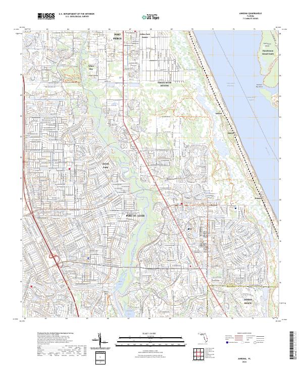
2024 Map of Ankona
USGS Topo · Published 2024About this map
The Saint Lucie River and its North Fork dominate this coastal landscape, shaping the development of the Florida Treasure Coast. The transition from suburban expansion in Port St. Lucie to the older coastal settlements of Ankona and Eldred highlights the area's growth patterns along the Intracoastal Waterway. To the east, Hutchinson Island South protects the Indian River Lagoon, where Herman Bay Point projects into the water. Inland, The Savannas and the Savannas Preserve State Park Trail preserve the unique freshwater marsh system that separates the coast from the developments of White City and Collins Park Estates. Significant recreational and transit routes are visible, including the East Coast Greenway and the Florida Circumnavigational Paddling Trail.
Find a feature on this map
57 named features on this map. Tap any name to fly to it.
Don’t see what you’re looking for? This feature index may not catch every label — zoom into the map to look around manually.
Map Details
Editions of this 2024 Ankona Map
This is the sole edition of this map. No revisions or reprints were ever made.
Other maps of this area

1948 · Palm City
USGS Topo · 1:24,000

1948 · Ankona
USGS Topo · 1:24,000

1948 · St. Lucie Inlet
USGS Topo · 1:24,000

1948 · Eden
USGS Topo · 1:24,000

1949 · Fort Pierce
USGS Topo · 1:24,000

1949 · Fort Pierce NW
USGS Topo · 1:24,000

1950 · St. Lucie Inlet
USGS Topo · 1:24,000

1950 · Ankona
USGS Topo · 1:24,000

1950 · Fort Pierce
USGS Topo · 1:24,000

1950 · Palm City
USGS Topo · 1:24,000