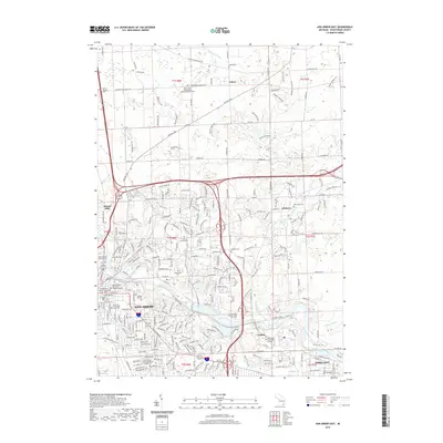
2019 Map of Ann Arbor East
USGS Topo · Published 2019About this map
The Huron River carves through this detailed 2019 survey of eastern Ann Arbor, revealing the dense institutional and educational landscape of Washtenaw County. The expansive campus of the University of Michigan Ann Arbor dominates the western edge, anchored by the Washtenaw County Courthouse, while higher education extends eastward to Cleary University, Concordia University Ann Arbor, and Washtenaw Community College. The transition from the urban core to the rural periphery is marked by a series of significant burial grounds, including the historic Forest Hill Cem and Fairview Cem near the river.
Find a feature on this map
253 named features on this map. Tap any name to fly to it.
Don’t see what you’re looking for? This feature index may not catch every label — zoom into the map to look around manually.
Map Details
Editions of this 2019 Ann Arbor East Map
This is the sole edition of this map. No revisions or reprints were ever made.
Other maps of this area

1902 · South Lyon
USGS Topo · 1:62,500

1902 · Ypsilanti
USGS Topo · 1:62,500

1902 · Dexter
USGS Topo · 1:62,500

1904 · Ann Arbor
USGS Topo · 1:125,000

1906 · Ypsilanti
USGS Topo · 1:62,500

1906 · Dexter
USGS Topo · 1:62,500

1906 · Saline
USGS Topo · 1:62,500

1906 · South Lyon
USGS Topo · 1:62,500

1908 · Ann Arbor
USGS Topo · 1:125,000
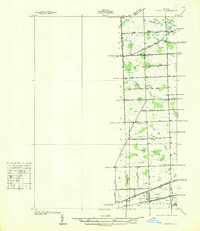
1936 · Denton
USGS Topo · 1:31,680
Featured Places
- Ann Arbor, MI
- Ypsilanti Charter Township, MI
- Pittsfield Charter Township, MI
- Ypsilanti, MI
- Superior Charter Township, MI