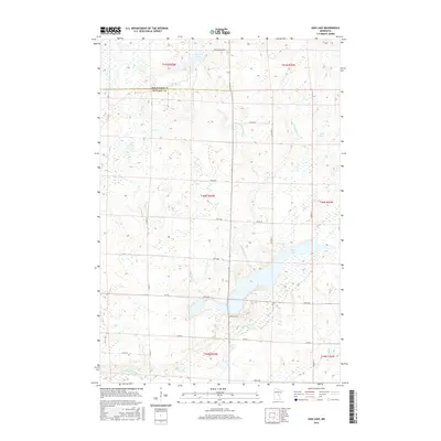
2016 Map of Ann Lake
USGS Topo · Published 2016About this map
Ann Lake and the winding Little Ann River dominate the central landscape of this Minnesota survey. The map details a transition point where the boundary between Mille Lacs Co and Kanabec Co meets, illustrating the hydrological network of the upper Midwest. To the north, Dewitt Pool sits near the headwaters of the river system, while smaller water bodies like Lake Seven and tributaries such as Mackey Brook and Camp Cr feed into the larger basins. The southern portion of the sheet is defined by the Groundhouse River and Spring Brook, showing a terrain largely shaped by glacial recession and water drainage. Local transportation is mapped through a grid of rural routes including Falcon St, Garden St, and Ann Lake Rd, which provide access to the various wetlands and watersheds that characterize this region.
Find a feature on this map
32 named features on this map. Tap any name to fly to it.
Don’t see what you’re looking for? This feature index may not catch every label — zoom into the map to look around manually.
Map Details
Editions of this 2016 Ann Lake Map
This is the sole edition of this map. No revisions or reprints were ever made.
Other maps of this area

1953 · Duluth
USGS Topo · 1:250,000

1953 · Stillwater
USGS Topo · 1:250,000

1955 · Stillwater
USGS Topo · 1:250,000

1958 · Stillwater
USGS Topo · 1:250,000

1958 · Duluth
USGS Topo · 1:250,000

1965 · Stillwater
USGS Topo · 1:250,000

1968 · Milaca NE
USGS Topo · 1:24,000

1968 · Ann Lake
USGS Topo · 1:24,000

1968 · Isle SW
USGS Topo · 1:24,000

1968 · Mora North
USGS Topo · 1:24,000
Featured Places
- Lewis Township, MN
- Hillman Township, MN
- Ann Lake Township, MN
- Knife Lake Township, MN
- Kanabec Township, MN