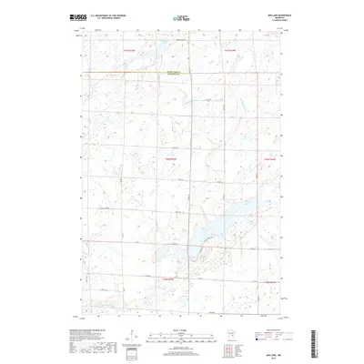
2019 Map of Ann Lake
USGS Topo · Published 2019About this map
The Ann River and Little Ann River converge in this wetland-rich corridor of east-central Minnesota, where the border of Mille Lacs and Kanabec counties is defined by the survey lines. This landscape is shaped by glacial topography, featuring numerous unnamed ponds and marshy depressions alongside identified water bodies like Dewitt Pool and Lake Seven. The drainage patterns are clearly visible through the winding courses of Camp Creek, Mackey Brook, and Spring Brook, which feed into the larger river systems. Historically, the area shows a sparse settlement pattern dominated by a grid of section-line roads such as 250th Ave and Garden St. The southern reaches are marked by the Groundhouse River, where the terrain begins to transition into more established secondary routes like Co Rd 6 and recreational pathways including Arctic Trl and Ve Trl.
Find a feature on this map
32 named features on this map. Tap any name to fly to it.
Don’t see what you’re looking for? This feature index may not catch every label — zoom into the map to look around manually.
Map Details
Editions of this 2019 Ann Lake Map
This is the sole edition of this map. No revisions or reprints were ever made.
Other maps of this area

1953 · Duluth
USGS Topo · 1:250,000

1953 · Stillwater
USGS Topo · 1:250,000

1955 · Stillwater
USGS Topo · 1:250,000

1958 · Stillwater
USGS Topo · 1:250,000

1958 · Duluth
USGS Topo · 1:250,000

1965 · Stillwater
USGS Topo · 1:250,000

1968 · Milaca NE
USGS Topo · 1:24,000

1968 · Ann Lake
USGS Topo · 1:24,000

1968 · Isle SW
USGS Topo · 1:24,000

1968 · Mora North
USGS Topo · 1:24,000
Featured Places
- Lewis Township, MN
- Hillman Township, MN
- Ann Lake Township, MN
- Knife Lake Township, MN
- Kanabec Township, MN