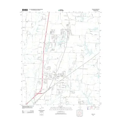
2013 Map of Anna
USGS Topo · Published 2013About this map
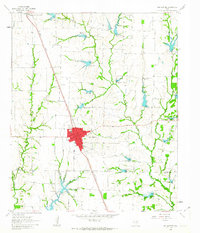
Anna and Melissa anchor this North Texas landscape, illustrating the rapid suburbanization of Collin County by the early 21st century. The map reveals a transition from traditional agricultural patterns to residential developments, with newer thoroughfares like Rosamond Pkwy and Fairway Ln cutting across the historical drainage basins of Throckmorton Cr and Slaughter Cr. Despite this growth, the area's rural heritage remains visible through its numerous family and community burial grounds, including Alexander Cem, Lair Cem, and Brinlee Cem. The topography is defined by the E Fork Trinity River in the west and several smaller tributaries such as Fitzhugh Br and Hatler Br to the southeast. Industrial and agricultural land use is represented by the Meat Producers Reservoir near the eastern boundary, while the northern settlement of Kelly marks the upper reaches of Hurricane Cr.
Find a feature on this map
195 named features on this map. Tap any name to fly to it.
Don’t see what you’re looking for? This feature index may not catch every label — zoom into the map to look around manually.
Map Details
Editions of this 2013 Anna Map
This is the sole edition of this map. No revisions or reprints were ever made.
Other maps of this area
1929 · McKinney
USGS Topo · 1:62,500
1930 · Farmersville
USGS Topo · 1:62,500

1954 · Sherman
USGS Topo · 1:250,000

1958 · Sherman
USGS Topo · 1:250,000
1960 · McKinney East
USGS Topo · 1:24,000
1960 · Blue Ridge
USGS Topo · 1:24,000
1960 · Culleoka
USGS Topo · 1:24,000
1960 · McKinney West
USGS Topo · 1:24,000
1961 · Gunter
USGS Topo · 1:24,000
1961 · Van Alstyne
USGS Topo · 1:24,000