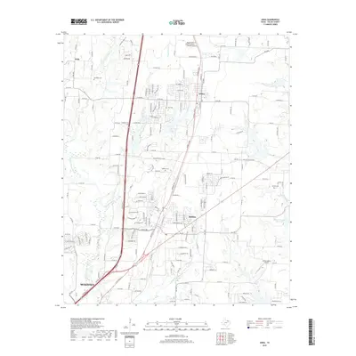
2019 Map of Anna
USGS Topo · Published 2019About this map
Anna and Melissa serve as central hubs in this northern Collin County landscape, showcasing the rapid development of the corridor between the Red River valley and Dallas. The terrain is defined by the winding course of the E Fork Trinity River and its numerous tributaries, including Throckmorton Cr, Stiff Cr, and Slaughter Cr. This 2019 survey documents a region in transition, where expansive rural road networks like W FM 455 and Co RD 284 increasingly interface with the growing northern reaches of McKinney.
Find a feature on this map
172 named features on this map. Tap any name to fly to it.
Don’t see what you’re looking for? This feature index may not catch every label — zoom into the map to look around manually.
Map Details
Editions of this 2019 Anna Map
This is the sole edition of this map. No revisions or reprints were ever made.
Other maps of this area

1929 · McKinney
USGS Topo · 1:62,500

1930 · Farmersville
USGS Topo · 1:62,500

1954 · Sherman
USGS Topo · 1:250,000

1958 · Sherman
USGS Topo · 1:250,000

1960 · McKinney East
USGS Topo · 1:24,000

1960 · Blue Ridge
USGS Topo · 1:24,000

1960 · Culleoka
USGS Topo · 1:24,000
1960 · McKinney West
USGS Topo · 1:24,000

1961 · Gunter
USGS Topo · 1:24,000

1961 · Van Alstyne
USGS Topo · 1:24,000