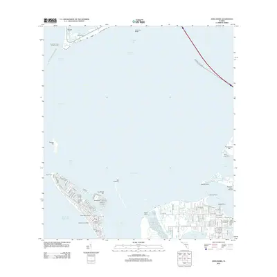
2012 Map of Anna Maria
USGS Topo · Published 2012About this map
Anna Maria Island and its surrounding coastal geography define this 2012 survey, revealing a landscape shaped by both natural waterways and residential development. The northern tip of the island at Bean Point transitions into the residential grid of Anna Maria, while the interior waters of Bimini Bay separate the main island from Key Royale Bar and School Key. Across the Anna Maria Sound, the mainland coast near the mouth of the Manatee River features significant cultural landmarks like the Portavant Indian Mound at Emerson Point. This area preserves archaeological history alongside modern infrastructure, such as the Sunshine Skyway Pier extending into Tampa Bay. The map also captures the offshore environment, including the protected lands of Fort De Soto Park - Egmont Key State Park and the distinct sandbars and shoals that navigate the Egmont Channel.
Find a feature on this map
109 named features on this map. Tap any name to fly to it.
Don’t see what you’re looking for? This feature index may not catch every label — zoom into the map to look around manually.
Map Details
Editions of this 2012 Anna Maria Map
This is the sole edition of this map. No revisions or reprints were ever made.
Other maps of this area

1921 · Fort De Soto
USGS Topo · 1:62,500

1942 · Cockroach Bay
USGS Topo · 1:31,680

1943 · Pass-A-Grille
USGS Topo · 1:31,680

1944 · Egmont Key
USGS Topo · 1:31,680

1944 · Anna Maria
USGS Topo · 1:31,680

1944 · Ellenton
USGS Topo · 1:31,680

1944 · Bradenton Beach
USGS Topo · 1:31,680

1945 · Cockroach Bay
USGS Topo · 1:31,680
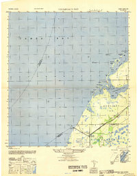
1947 · Cockroach Bay
USGS Topo · 1:25,000

1947 · Bradenton
USGS Topo · 1:24,000