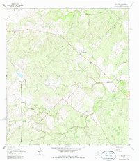
1963 Map of Anna Rose
USGS Topo · Published 1985About this map
Anna Rose sits at the heart of this brush country landscape where the borders of Live Oak, Jim Wells, and Duval counties meet. In the early 1960s, this region was defined by a ranching and petroleum economy, evidenced by the extensive Ramirena Oil Field and Amargosa Oil Field that punctuate the terrain. The map records several named ranching sites including Freeborn Ranch and the Rancho de la Parrita, along with a network of essential water sources like the Lagarto Windmill and Patterson Windmill. Drainage follows a series of seasonal creek beds such as Ramirena Creek, Kentucky Creek, and Lagarto Creek, which carve through the low hills and flats. For genealogists and local historians, the inclusion of a Cem near the confluence of several creeks provides a focal point for family research in this sparsely populated cattle country.
Find a feature on this map
25 named features on this map. Tap any name to fly to it.
Don’t see what you’re looking for? This feature index may not catch every label — zoom into the map to look around manually.
Map Details
Editions of this 1963 Anna Rose Map
2 editions found
Other maps of this area

1920 · Mikeska
USGS Topo · 1:125,000

1920 · San Diego
USGS Topo · 1:62,500

1953 · Crystal City
USGS Topo · 1:250,000

1955 · Crystal City
USGS Topo · 1:250,000

1956 · Rosita Ranch
USGS Topo · 1:62,500

1956 · Laredo
USGS Topo · 1:250,000

1961 · Crystal City
USGS Topo · 1:250,000
1963 · Anna Rose
USGS Topo · 1:24,000

1963 · San Diego NE
USGS Topo · 1:24,000
1963 · Crater Ridge
USGS Topo · 1:24,000