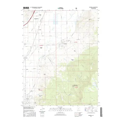
2017 Map of Annabella
USGS Topo · Published 2017About this map
The Sevier River valley serves as a fertile corridor for the agricultural settlements of Annabella, Central Valley, and Monroe. This landscape is defined by an intricate network of irrigation systems, including the Sevier Valley Canal, Annabella Canal, and Bertlesen Ditch, which redirect water from the river to support local farming. To the east, the terrain rises sharply into the high country of the Fishlake National Forest, where water management continues with the Annabella Reservoir and Annabella Deep Lake tucked into the canyons. Genealogists will find detailed locations for several local burial grounds, such as Annabella Cem, Central Valley Cem, and the Monroe City Cem. The presence of the Richfield Municipal Airport and Industrial Park Road reflects the modern industrial and transportation infrastructure north of the traditional town centers.
Find a feature on this map
97 named features on this map. Tap any name to fly to it.
Don’t see what you’re looking for? This feature index may not catch every label — zoom into the map to look around manually.
Map Details
Editions of this 2017 Annabella Map
This is the sole edition of this map. No revisions or reprints were ever made.
Other maps of this area

1885 · Beaver
USGS Topo · 1:250,000

1885 · Fish Lake
USGS Topo · 1:250,000

1896 · Fish Lake
USGS Topo · 1:250,000

1940 · Monroe
USGS Topo · 1:62,500

1944 · Monroe
USGS Topo · 1:62,500

1953 · Richfield
USGS Topo · 1:250,000

1956 · Salina
USGS Topo · 1:250,000

1958 · Richfield
USGS Topo · 1:250,000

1960 · Salina
USGS Topo · 1:250,000

1961 · Richfield
USGS Topo · 1:62,500