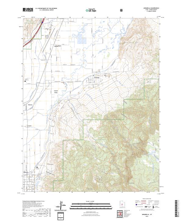
2023 Map of Annabella
USGS Topo · Published 2023About this map
The Sevier River valley serves as the primary artery for settlement and agriculture in this section of Sevier County. The complex network of irrigation, including the Sevier Valley Canal, Elsinore Canal, and Annabella Canal, demonstrates a long-standing reliance on managed water systems to support the communities of Richfield, Annabella, and Central Valley. To the west, the foothills of the Pahvant Range rise sharply, while the eastern portion of the map is dominated by the high-elevation terrain of the Fishlake National Forest, culminating at Signal Peak.
Find a feature on this map
100 named features on this map. Tap any name to fly to it.
Don’t see what you’re looking for? This feature index may not catch every label — zoom into the map to look around manually.
Map Details
Editions of this 2023 Annabella Map
This is the sole edition of this map. No revisions or reprints were ever made.
Historical Maps of Jensen Through Time
3 maps found