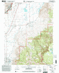
2001 Map of Annabella
USGS Topo · Published 2003About this map
The Sevier River and an extensive network of irrigation infrastructure define this agricultural corridor at the base of the Fishlake National Forest. The landscape is dominated by engineering efforts to manage water, featuring the Prattsville Canal, Richfield Canal, Elsinore Canal, and Annabella Canal which trace the valley floor. These waterways sustain the tight-knit communities of Annabella, Central Valley, and the northern edge of Monroe. To the east, the terrain rises sharply into the plateaus of Glenwood Mountain, where high-altitude water sources like Annabella Reservoir and Duck Lake are situated near Signal Peak. The map captures the interface between the municipal activity at the Municipal Airport near Richfield and the isolated livestock or timber paths in Winget Canyon and Order Dugway Canyon, providing a detailed view of the rural-industrial balance in Sevier County.
Find a feature on this map
36 named features on this map. Tap any name to fly to it.
Don’t see what you’re looking for? This feature index may not catch every label — zoom into the map to look around manually.
Map Details
Editions of this 2001 Annabella Map
This is the sole edition of this map. No revisions or reprints were ever made.
Other maps of this area

1885 · Beaver
USGS Topo · 1:250,000

1885 · Fish Lake
USGS Topo · 1:250,000

1896 · Fish Lake
USGS Topo · 1:250,000

1940 · Monroe
USGS Topo · 1:62,500

1944 · Monroe
USGS Topo · 1:62,500

1953 · Richfield
USGS Topo · 1:250,000

1956 · Salina
USGS Topo · 1:250,000

1958 · Richfield
USGS Topo · 1:250,000

1960 · Salina
USGS Topo · 1:250,000

1961 · Richfield
USGS Topo · 1:62,500