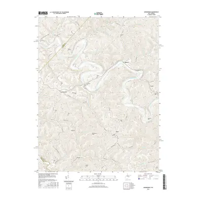
2016 Map of Annamoriah
USGS Topo · Published 2016About this map
The Little Kanawha River carves a dramatic, winding path through Calhoun County, forming a series of deep loops that define the local geography. At one of these sharp river bends, the settlement of Bigbend sits across from the namesake Bigbend Cem, while further downstream the community of Annamoriah and the Annamoriah Flats occupy the valley floor near the Annamoriah Bridge. The terrain is characterized by steep ridges and hollows, where small settlements like Joker, Cremo, and Purdy are connected by a network of winding county roads such as Joker Hur Rd and Hardman Fork Rd. Numerous family and community burial grounds, including Sixteen Ridge Cem, Goodnight Cem, and Snyder Chapel Cem, are scattered across the uplands, often situated on high points like Husk Ridge. This landscape illustrates the persistent rural settlement patterns of the West Virginia hills, where life remains oriented toward the narrow river bottoms and the prominent peaks like Rattlesnake Knob.
Find a feature on this map
84 named features on this map. Tap any name to fly to it.
Don’t see what you’re looking for? This feature index may not catch every label — zoom into the map to look around manually.
Map Details
Editions of this 2016 Annamoriah Map
This is the sole edition of this map. No revisions or reprints were ever made.
Other maps of this area

1906 · Elizabeth
USGS Topo · 1:62,500

1907 · Harrisville
USGS Topo · 1:62,500

1907 · Arnoldsburg
USGS Topo · 1:62,500

1907 · Spencer
USGS Topo · 1:62,500

1924 · Harrisville
USGS Topo · 1:62,500

1924 · Elizabeth
USGS Topo · 1:62,500

1925 · Arnoldsburg
USGS Topo · 1:62,500

1926 · Elizabeth
USGS Topo · 1:62,500

1926 · Harrisville
USGS Topo · 1:62,500

1927 · Arnoldsburg
USGS Topo · 1:62,500