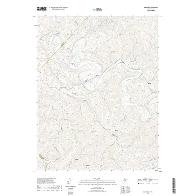
2019 Map of Annamoriah
USGS Topo · Published 2019About this map
The Little Kanawha River carves a dramatic, winding course through this section of Calhoun County, defining the movement of people and commerce between settlements like Annamoriah and Big Bend. The river's deep meanders create distinctive landforms such as Annamoriah Flats and Hardman Bend, while the surrounding uplands are marked by high points including Rattlesnake Knob and Palsor Knob. This 2019 survey documents a landscape where community life is anchored by dispersed rural settlements like Joker, Cremo, and Purdy.
Find a feature on this map
84 named features on this map. Tap any name to fly to it.
Don’t see what you’re looking for? This feature index may not catch every label — zoom into the map to look around manually.
Map Details
Editions of this 2019 Annamoriah Map
This is the sole edition of this map. No revisions or reprints were ever made.
Other maps of this area

1906 · Elizabeth
USGS Topo · 1:62,500

1907 · Harrisville
USGS Topo · 1:62,500

1907 · Arnoldsburg
USGS Topo · 1:62,500

1907 · Spencer
USGS Topo · 1:62,500

1924 · Harrisville
USGS Topo · 1:62,500

1924 · Elizabeth
USGS Topo · 1:62,500

1925 · Arnoldsburg
USGS Topo · 1:62,500

1926 · Elizabeth
USGS Topo · 1:62,500

1926 · Harrisville
USGS Topo · 1:62,500

1927 · Arnoldsburg
USGS Topo · 1:62,500