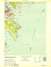
1953 Map of Annapolis
USGS Topo · Published 1953About this map
The U S Naval Academy and the city of Annapolis anchor this mid-century coastal survey, illustrating the dense maritime infrastructure where the Severn River meets the Chesapeake Bay. The map reveals a post-war waterfront landscape defined by the Seaplane Base on Greenbury Pt and the Naval Hospital near Wardour. Beyond the city center, established communities like Eastport and Bay Ridge line the shorelines of Spa Creek and Back Creek, while the Thomas Point Shoal Lighthouse stands offshore in the bay. This era of Maryland's history is reflected in the residential patterns of Highland Beach and Arundel on the Bay, connected to the mainland by the prominent Bay Ridge Road. The landscape is a complex network of tidal inlets like Duvall Creek and Lake Ogleton, providing insight into the region's long-standing reliance on its intricate waterways.
Find a feature on this map
60 named features on this map. Tap any name to fly to it.
Don’t see what you’re looking for? This feature index may not catch every label — zoom into the map to look around manually.
Map Details
Editions of this 1953 Annapolis Map
This is the sole edition of this map. No revisions or reprints were ever made.
Other maps of this area

1892 · Owensville
USGS Topo · 1:62,500

1892 · Annapolis
USGS Topo · 1:62,500

1893 · North Point
USGS Topo · 1:62,500

1894 · Relay
USGS Topo · 1:62,500

1895 · Owensville
USGS Topo · 1:62,500

1898 · Choptank
USGS Topo · 1:125,000

1898 · Tolchester
USGS Topo · 1:125,000

1899 · Patuxent
USGS Topo · 1:125,000

1903 · Tolchester
USGS Topo · 1:125,000

1904 · North Point
USGS Topo · 1:62,500