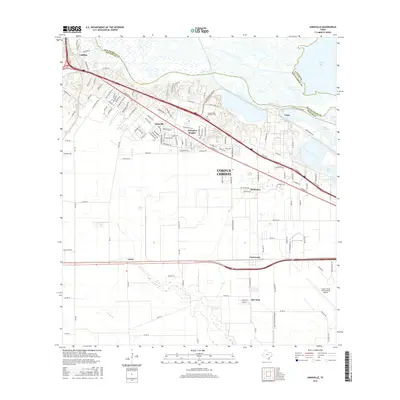
2016 Map of Annaville
USGS Topo · Published 2016About this map
The Nueces River marks the transition from the wetlands of Nueces Bay to the expanding residential and industrial corridors of northwest Corpus Christi. In the mid-2010s, this area reflects a landscape structured by major transportation routes like Leopard St, which links established communities such as Annaville and Arlington Heights with the industrial shipping infrastructure at Viola. The northern portion of the map highlights the proximity of the Coastal Bend Veterans Cem to the river, while the southern reach transitions into the agricultural grids surrounding Violet and Clarkwood. This survey provides a precise look at the intersection of maritime transport near the Viola Channel and Tule Lake with the aviation hub at Corpus Christi International Airport. Local features like Oso Cr and numerous residential streets provide fine-grained detail for modern local history research.
Find a feature on this map
131 named features on this map. Tap any name to fly to it.
Don’t see what you’re looking for? This feature index may not catch every label — zoom into the map to look around manually.
Map Details
Editions of this 2016 Annaville Map
This is the sole edition of this map. No revisions or reprints were ever made.
Other maps of this area

1924 · Petronilla
USGS Topo · 1:62,500

1925 · Robstown
USGS Topo · 1:62,500

1925 · Oso Creek
USGS Topo · 1:62,500

1925 · Corpus Christi
USGS Topo · 1:62,500

1950 · Corpus Christi
USGS Topo · 1:250,000

1951 · Corpus Christi
USGS Topo · 1:24,000

1951 · Corpus Christi
USGS Topo · 1:62,500

1951 · Oso Creek NW
USGS Topo · 1:24,000

1951 · Oso Creek
USGS Topo · 1:62,500

1954 · Robstown
USGS Topo · 1:62,500
Featured Places
- Corpus Christi, TX
- Clarkwood, Corpus Christi
- Violet, TX
- McNorton, Corpus Christi
- San Juan, Corpus Christi