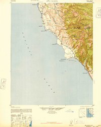
1942 Map of Ano Nuevo
USGS Topo · Published 1948About this map
The rugged shoreline of the Central California coast is defined by its dramatic points and agricultural outposts in the years following the 1937-1940 aerial surveys. Stretching from Pescadero Point down to Greyhound Rock, the landscape is a mix of coastal terraces and the steep, wooded slopes of The Chalks. While the interior reveals industrial activity at Chalks Lookout and the remnants of Whitehouse Camp (Abandoned), the coast remains anchored by long-standing agricultural holdings like Coastways Ranch and Rancho Del Oso.
Find a feature on this map
27 named features on this map. Tap any name to fly to it.
Don’t see what you’re looking for? This feature index may not catch every label — zoom into the map to look around manually.
Map Details
Editions of this 1942 Ano Nuevo Map
2 editions found
Other maps of this area

1897 · Palo Alto
USGS Topo · 1:62,500

1899 · Palo Alto
USGS Topo · 1:62,500

1902 · Santa Cruz
USGS Topo · 1:125,000

1940 · Halfmoon Bay
USGS Topo · 1:62,500

1940 · Ano Nuevo
USGS Topo · 1:62,500

1941 · Ano Nuevo Pt.
USGS Topo · 1:62,500

1941 · Palo Alto
USGS Topo · 1:62,500

1942 · Ano Nuevo
USGS Topo · 1:62,500

1943 · Palo Alto
USGS Topo · 1:62,500

1943 · Halfmoon Bay
USGS Topo · 1:62,500