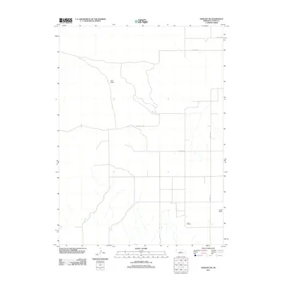
2011 Map of Anselmo SW
USGS Topo · Published 2011About this map
Ortello Cemetery serves as a quiet local landmark in this pocket of Custer County, situated near the head of Ortello Valley. The landscape is defined by the shifting geography of the Nebraska Sandhills, where drainage patterns and road networks follow the natural contours of Sand Valley and Eureka Valley. This 2011 survey by the U.S. Geological Survey illustrates the intersection of rural agriculture and traditional terrain, where Anselmo Rd and Eureka Valley Rd provide the primary transit across the undulating valley floors. The map details a sparsely populated area where the vastness of the valley systems dictated the placement of early homesteads and communal burial sites, preserving a layout that remained relatively consistent into the early 21st century.
Find a feature on this map
8 named features on this map. Tap any name to fly to it.
Don’t see what you’re looking for? This feature index may not catch every label — zoom into the map to look around manually.
Map Details
Editions of this 2011 Anselmo SW Map
This is the sole edition of this map. No revisions or reprints were ever made.
Other maps of this area

1948 · Linscott
USGS Topo · 1:62,500

1950 · Linscott
USGS Topo · 1:62,500

1951 · Callaway NW
USGS Topo · 1:24,000

1951 · Anselmo
USGS Topo · 1:24,000

1951 · Merna
USGS Topo · 1:24,000

1951 · Anselmo SW
USGS Topo · 1:24,000

1951 · Anselmo NE
USGS Topo · 1:24,000

1951 · Anselmo NW
USGS Topo · 1:24,000

1954 · North Platte
USGS Topo · 1:250,000

1955 · Broken Bow
USGS Topo · 1:250,000