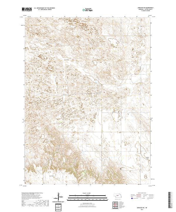
2021 Map of Anselmo SW
USGS Topo · Published 2021About this map
Ortello Valley and Sand Valley dominate this Custer County landscape, illustrating the topographic transition between the Nebraska Sandhills and the productive loess plateaus. The southern reach of the map features West Table, a distinctive elevated landform characteristic of the region's agricultural geography. Local history is anchored by the Ortello Cem in the southeast, situated near the intersection of RD 427 and RD 808. The rural infrastructure is defined by a grid of section-line roads, including Anselmo Rd and Min Main Rd, which navigate the varying elevations between Eureka Valley and the surrounding hills. This survey by the U.S. Geological Survey captures the specialized land use patterns of central Nebraska, where deep valleys and flat-topped tables dictate the placement of ranching homesteads and transport corridors.
Find a feature on this map
18 named features on this map. Tap any name to fly to it.
Don’t see what you’re looking for? This feature index may not catch every label — zoom into the map to look around manually.
Map Details
Editions of this 2021 Anselmo SW Map
This is the sole edition of this map. No revisions or reprints were ever made.
Other maps of this area

1948 · Linscott
USGS Topo · 1:62,500

1950 · Linscott
USGS Topo · 1:62,500

1951 · Callaway NW
USGS Topo · 1:24,000

1951 · Anselmo
USGS Topo · 1:24,000

1951 · Merna
USGS Topo · 1:24,000

1951 · Anselmo SW
USGS Topo · 1:24,000

1951 · Anselmo NE
USGS Topo · 1:24,000

1951 · Anselmo NW
USGS Topo · 1:24,000

1954 · North Platte
USGS Topo · 1:250,000

1955 · Broken Bow
USGS Topo · 1:250,000