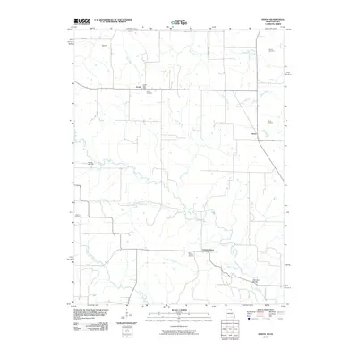
2010 Map of Anson
USGS Topo · Published 2010About this map
The Fox River and Little Fox River define the winding drainage patterns of this Clark County landscape, where small rural hubs like Chambersburg and Anson anchor the agricultural community. This 2010 survey details a region marked by numerous family and community burial grounds, including the Anderson Cemetery, Christy Cemetery, and Saint Thomas Cemetery, which offer valuable coordinates for genealogists tracing local lineages. The settlement at Acasto remains a focal point, noted for the Acasto Post Office and its proximity to Coon Creek. Transportation across the river systems is highlighted by specific crossings such as the Fehlhaber Bridge and water management features like the Herring Lake Dam. The map's grid-like road network, featuring routes like Quill Rd and Unicorn Ave, connects these scattered settlements and landmarks across the varied terrain of northern Missouri.
Find a feature on this map
28 named features on this map. Tap any name to fly to it.
Don’t see what you’re looking for? This feature index may not catch every label — zoom into the map to look around manually.
Map Details
Editions of this 2010 Anson Map
This is the sole edition of this map. No revisions or reprints were ever made.
Other maps of this area

1903 · Kahoka
USGS Topo · 1:125,000

1949 · Kahoka
USGS Topo · 1:24,000

1950 · Kahoka
USGS Topo · 1:24,000

1950 · Medill
USGS Topo · 1:24,000

1951 · Medill
USGS Topo · 1:24,000

1951 · Wyaconda
USGS Topo · 1:24,000

1958 · Burlington
USGS Topo · 1:250,000

1961 · Burlington
USGS Topo · 1:250,000

1963 · Burlington
USGS Topo · 1:250,000

1968 · Anson
USGS Topo · 1:24,000