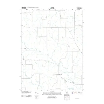
2012 Map of Anson
USGS Topo · Published 2012About this map
Chambersburg and the small settlements of Acasto and Anson anchor this rural landscape along the Missouri-Iowa border in Clark County. The meandering Fox River and its tributary, the Little Fox River, dictate the topography, creating a network of drainages including Mantle Branch and Kaylor Branch. For genealogists, the map is particularly rich with family-named burial sites such as Anderson Cemetery, Burrier Cemetery, and Christy Cemetery, which reflect the generations of farming families that established these prairie communities.
Find a feature on this map
32 named features on this map. Tap any name to fly to it.
Don’t see what you’re looking for? This feature index may not catch every label — zoom into the map to look around manually.
Map Details
Editions of this 2012 Anson Map
This is the sole edition of this map. No revisions or reprints were ever made.
Other maps of this area

1903 · Kahoka
USGS Topo · 1:125,000

1949 · Kahoka
USGS Topo · 1:24,000

1950 · Kahoka
USGS Topo · 1:24,000

1950 · Medill
USGS Topo · 1:24,000

1951 · Medill
USGS Topo · 1:24,000

1951 · Wyaconda
USGS Topo · 1:24,000

1958 · Burlington
USGS Topo · 1:250,000

1961 · Burlington
USGS Topo · 1:250,000

1963 · Burlington
USGS Topo · 1:250,000

1968 · Anson
USGS Topo · 1:24,000