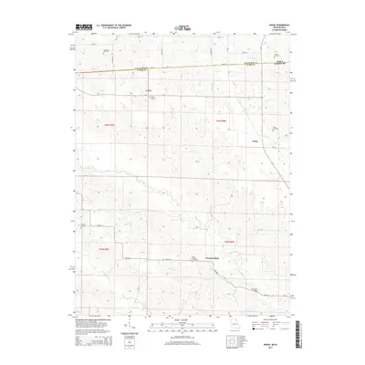
2014 Map of Anson
USGS Topo · Published 2014About this map
Chambersburg and Anson anchor this rural landscape in northeastern Missouri, situated just south of the Iowa Missouri state line. The terrain is defined by the winding course of the Fox River and the Little Fox River, with numerous tributaries like Mantle Br and Kaylor Br carving through the agricultural sections. For those tracing local history, the map provides precise locations for several family-named landmarks including Christy Cemetery, Anderson Cemetery, and Troxel Cemetery. The settlement of Acasto sits in the northern reaches, while the Fehlhaber Bridge spans a crossing to the southeast. This survey reflects the enduring character of a borderland community where long-established townships are organized around watercourses and county roads like Mo-NN and CR-j56.
Find a feature on this map
37 named features on this map. Tap any name to fly to it.
Don’t see what you’re looking for? This feature index may not catch every label — zoom into the map to look around manually.
Map Details
Editions of this 2014 Anson Map
This is the sole edition of this map. No revisions or reprints were ever made.
Other maps of this area

1903 · Kahoka
USGS Topo · 1:125,000

1949 · Kahoka
USGS Topo · 1:24,000

1950 · Kahoka
USGS Topo · 1:24,000

1950 · Medill
USGS Topo · 1:24,000

1951 · Medill
USGS Topo · 1:24,000

1951 · Wyaconda
USGS Topo · 1:24,000

1958 · Burlington
USGS Topo · 1:250,000

1961 · Burlington
USGS Topo · 1:250,000

1963 · Burlington
USGS Topo · 1:250,000

1968 · Anson
USGS Topo · 1:24,000