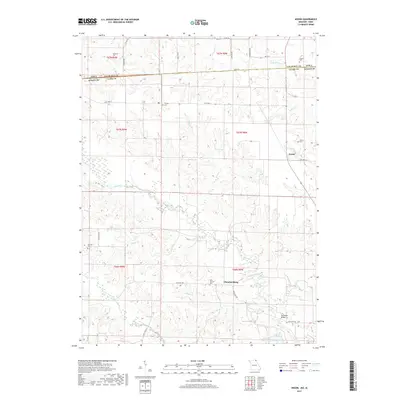
2017 Map of Anson
USGS Topo · Published 2017About this map
The Fox River and Little Fox River dominate the landscape of this border region where Clark County, Missouri, meets Van Buren County, Iowa. The small village of Chambersburg serves as a local hub near the southern edge, while the settlement of Anson is situated further north along State Hwy CC. This area is particularly rich in genealogical data, preserving the locations of numerous family and community burial grounds, including Anderson Cem, Burrier Cem, and Saint Thomas Cem. The road network is a mix of state highways and named rural routes like Unicorn Ave and Reddud Ave, reflecting a persistent pattern of agricultural land divisions. In the southeastern corner, the Fehlhaber Bridge provides a crossing over the river, while smaller tributaries such as Mantle Br and Kaylor Br carve through the terrain, illustrating the intricate drainage system that defines the local topography.
Find a feature on this map
37 named features on this map. Tap any name to fly to it.
Don’t see what you’re looking for? This feature index may not catch every label — zoom into the map to look around manually.
Map Details
Editions of this 2017 Anson Map
This is the sole edition of this map. No revisions or reprints were ever made.
Other maps of this area

1903 · Kahoka
USGS Topo · 1:125,000

1949 · Kahoka
USGS Topo · 1:24,000

1950 · Kahoka
USGS Topo · 1:24,000

1950 · Medill
USGS Topo · 1:24,000

1951 · Medill
USGS Topo · 1:24,000

1951 · Wyaconda
USGS Topo · 1:24,000

1958 · Burlington
USGS Topo · 1:250,000

1961 · Burlington
USGS Topo · 1:250,000

1963 · Burlington
USGS Topo · 1:250,000

1968 · Anson
USGS Topo · 1:24,000