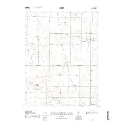
2019 Map of Ansonia
USGS Topo · Published 2019About this map
Ansonia serves as a primary hub for this portion of Darke County, where the Stillwater River and its various forks define the drainage of the agricultural landscape. The township structure of the late 2010s remains heavily tied to its early rural foundations, evidenced by the high density of small family and community burial grounds such as Old Teagarden Cem, Beeler Cem, and Bethel Cem scattered across the township lines of t13n r1e and t13n r2e.
Find a feature on this map
49 named features on this map. Tap any name to fly to it.
Don’t see what you’re looking for? This feature index may not catch every label — zoom into the map to look around manually.
Map Details
Editions of this 2019 Ansonia Map
This is the sole edition of this map. No revisions or reprints were ever made.
Other maps of this area

1908 · St. Henry
USGS Topo · 1:62,500

1915 · Fort Recovery
USGS Topo · 1:48,000

1916 · Winchester
USGS Topo · 1:48,000

1918 · Winchester
USGS Topo · 1:62,500

1918 · Fort Recovery
USGS Topo · 1:62,500

1943 · Winchester
USGS Topo · 1:62,500

1953 · Muncie
USGS Topo · 1:250,000

1956 · Muncie
USGS Topo · 1:250,000

1960 · Union City
USGS Topo · 1:24,000
1960 · Spartanburg
USGS Topo · 1:24,000