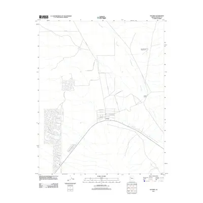
2011 Map of Antares
USGS Topo · Published 2011About this map
Antares serves as a central point in this high-desert landscape of Mohave County, where the sprawling residential street networks of Valle Vista meet the open range. The map reveals a transition from the structured residential blocks near Monte Tesoro Dr and Olympic Ave to the vast, undeveloped terrain defined by Truxton Wash. This seasonal drainage system winds through the eastern portion of the sheet toward Truxton Canyon, marking a significant natural corridor in an otherwise arid environment.
Find a feature on this map
31 named features on this map. Tap any name to fly to it.
Don’t see what you’re looking for? This feature index may not catch every label — zoom into the map to look around manually.
Map Details
Editions of this 2011 Antares Map
This is the sole edition of this map. No revisions or reprints were ever made.
Other maps of this area

1886 · Diamond Creek
USGS Topo · 1:250,000

1892 · Diamond Creek
USGS Topo · 1:250,000

1948 · Williams
USGS Topo · 1:250,000

1954 · Williams
USGS Topo · 1:250,000

1956 · Williams
USGS Topo · 1:250,000

1960 · Williams
USGS Topo · 1:250,000

1961 · Williams
USGS Topo · 1:250,000

1967 · Milkweed Canyon SW
USGS Topo · 1:24,000
1968 · Long Mountain
USGS Topo · 1:24,000
1968 · Kingman Airport
USGS Topo · 1:24,000