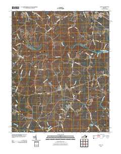
2010 Map of Ante
USGS Topo · Published 2010About this map
Ante and Harris Crossroads serve as central points in this rural Brunswick County landscape, where the Meherrin River winds through a network of creeks and family farms. The map documents a classic Southside Virginia settlement pattern, characterized by small communities like Pleasant Shade, Totaro, and Radium connected by an intricate web of local roads such as Halifax Rd and Brunswick Rd. Genealogists will find significant value in the numerous family and church burial sites scattered across the quadrangle, including the New Hope Zion Cemetery, Powell Cemetery, and Cordie Cemetery.
Find a feature on this map
58 named features on this map. Tap any name to fly to it.
Don’t see what you’re looking for? This feature index may not catch every label — zoom into the map to look around manually.
Map Details
Editions of this 2010 Ante Map
This is the sole edition of this map. No revisions or reprints were ever made.
Other maps of this area

1918 · Lawrenceville
USGS Topo · 1:62,500

1919 · Mc Kenney
USGS Topo · 1:48,000

1919 · White Plains
USGS Topo · 1:48,000

1919 · Emporia
USGS Topo · 1:62,500

1920 · Lawrenceville
USGS Topo · 1:48,000

1920 · White Plains
USGS Topo · 1:62,500

1921 · Mc Kenney
USGS Topo · 1:62,500

1921 · Lawrenceville
USGS Topo · 1:62,500

1942 · Lawrenceville
USGS Topo · 1:62,500

1942 · Emporia
USGS Topo · 1:62,500