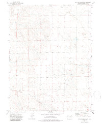
1973 Map of Antelope Creek East
USGS Topo · Published 1986About this map
The High Plains of Washington County, Colorado, are defined by a sparse network of seasonal drainages and scattered agricultural landmarks. The terrain is marked by the winding courses of Buck Creek, Hell Creek, and Antelope Creek, which carve subtle depressions into the arid landscape. This 1970s survey captures the region's isolated rural character, where large sections of land are delineated by fence lines and section boundaries. A central point of local historical interest is the Elba Cem, a quiet site of remembrance situated near the township line between T 1 S and T 2 S. The presence of a Gravel Pit suggests the localized extraction of materials used for maintaining the area's unpaved road network, reflecting the practical needs of this remote ranching and farming community.
Find a feature on this map
7 named features on this map. Tap any name to fly to it.
Don’t see what you’re looking for? This feature index may not catch every label — zoom into the map to look around manually.
Map Details
Editions of this 1973 Antelope Creek East Map
2 editions found
Other maps of this area

1954 · Limon
USGS Topo · 1:250,000

1954 · Sterling
USGS Topo · 1:250,000

1957 · Limon
USGS Topo · 1:250,000

1958 · Limon
USGS Topo · 1:250,000

1958 · Sterling
USGS Topo · 1:250,000

1973 · Antelope Creek East
USGS Topo · 1:24,000

1973 · Antelope Creek West
USGS Topo · 1:24,000

1973 · Dry Gulch
USGS Topo · 1:24,000

1973 · Rago
USGS Topo · 1:24,000

1973 · Antelope Creek SE
USGS Topo · 1:24,000