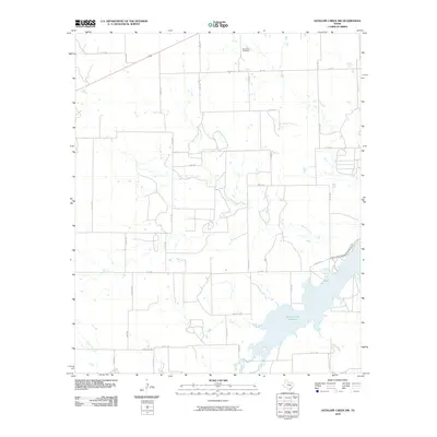
2010 Map of Antelope Creek NW
USGS Topo · Published 2010About this map
Millers Creek Reservoir dominates the southeastern portion of this landscape, serving as a primary hydrological focal point for the surrounding plains. The terrain is defined by several seasonal watercourses that drain toward the reservoir or the southern reaches, including the winding Mexican Creek and Wolf Creek. In the northern section, the solitary Bomarton Cemetery sits near the crossing of FM 1152 and Co RD 467, indicating the long-standing rural community centers of Knox County. A dense grid of county roads, such as Co RD 471 and Rock Rd, outlines a region dedicated to agriculture and livestock. This 2010 survey shows the modern rural layout, where historical drainage patterns like Lake Creek and Rocky Creek continue to shape the placement of ranch access roads and property boundaries.
Find a feature on this map
38 named features on this map. Tap any name to fly to it.
Don’t see what you’re looking for? This feature index may not catch every label — zoom into the map to look around manually.
Map Details
Editions of this 2010 Antelope Creek NW Map
This is the sole edition of this map. No revisions or reprints were ever made.
Other maps of this area

1954 · Wichita Falls
USGS Topo · 1:250,000

1958 · Wichita Falls
USGS Topo · 1:250,000

1962 · Antelope Creek SW
USGS Topo · 1:24,000

1962 · Antelope Creek SE
USGS Topo · 1:24,000

1962 · Antelope Creek NE
USGS Topo · 1:24,000

1962 · Antelope Creek NW
USGS Topo · 1:24,000

1966 · Seymour West
USGS Topo · 1:24,000

1966 · Bomarton
USGS Topo · 1:24,000

1967 · Hefner
USGS Topo · 1:24,000

1967 · Mattson
USGS Topo · 1:24,000