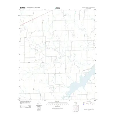
2012 Map of Antelope Creek NW
USGS Topo · Published 2012About this map
Bomarton Cem serves as a quiet landmark in this Knox County landscape, situated amidst a grid of rural county roads. The southern portion of the area is defined by the significant reach of the Millers Cr Reservoir, where the waters of Mexican Cr and Lake Cr eventually drain. This 2012 survey illustrates the land-use patterns of North Central Texas, where ranching and agricultural operations are serviced by thoroughfares like Ranch Road 1608 and FM-1752. The drainage network, including Rocky Cr and Walker Cr, creates subtle variations in the terrain, providing natural boundaries between the large parcels of land. For researchers, the map clarifies the modern spatial relationship between established family burial sites and the expanding reservoir shoreline.
Find a feature on this map
44 named features on this map. Tap any name to fly to it.
Don’t see what you’re looking for? This feature index may not catch every label — zoom into the map to look around manually.
Map Details
Editions of this 2012 Antelope Creek NW Map
This is the sole edition of this map. No revisions or reprints were ever made.
Other maps of this area

1954 · Wichita Falls
USGS Topo · 1:250,000

1958 · Wichita Falls
USGS Topo · 1:250,000

1962 · Antelope Creek SW
USGS Topo · 1:24,000

1962 · Antelope Creek SE
USGS Topo · 1:24,000

1962 · Antelope Creek NE
USGS Topo · 1:24,000

1962 · Antelope Creek NW
USGS Topo · 1:24,000

1966 · Seymour West
USGS Topo · 1:24,000

1966 · Bomarton
USGS Topo · 1:24,000

1967 · Hefner
USGS Topo · 1:24,000

1967 · Mattson
USGS Topo · 1:24,000