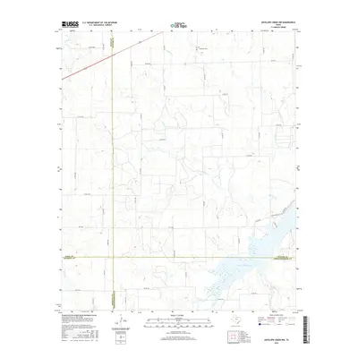
2016 Map of Antelope Creek NW
USGS Topo · Published 2016About this map
Millers Cr Reservoir dominates the southeastern corner of this landscape, marking the convergence of the central Texas plains at the intersection of four counties. The map captures the meeting point of Knox, Baylor, Haskell, and Throckmorton counties, a region defined by a grid of county roads and meandering drainage systems like Mexican Cr and Lake Cr. To the north, the Bomarton Cem stands as a focal point for local genealogical interest near the path of highway 277. The terrain is characterized by these intermittent creek beds and a dense network of local routes, including Miller Loop and Rock Rd, which reflect the rural agricultural and ranching layout of the area in the early twenty-first century.
Find a feature on this map
45 named features on this map. Tap any name to fly to it.
Don’t see what you’re looking for? This feature index may not catch every label — zoom into the map to look around manually.
Map Details
Editions of this 2016 Antelope Creek NW Map
This is the sole edition of this map. No revisions or reprints were ever made.
Other maps of this area

1954 · Wichita Falls
USGS Topo · 1:250,000

1958 · Wichita Falls
USGS Topo · 1:250,000

1962 · Antelope Creek SW
USGS Topo · 1:24,000

1962 · Antelope Creek SE
USGS Topo · 1:24,000

1962 · Antelope Creek NE
USGS Topo · 1:24,000

1962 · Antelope Creek NW
USGS Topo · 1:24,000

1966 · Seymour West
USGS Topo · 1:24,000

1966 · Bomarton
USGS Topo · 1:24,000

1967 · Hefner
USGS Topo · 1:24,000

1967 · Mattson
USGS Topo · 1:24,000