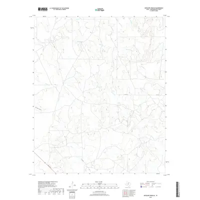
2019 Map of Antelope Creek SE
USGS Topo · Published 2019About this map
Antelope Lake and Swenson Lake serve as focal points in this drainage basin within Throckmorton County. The landscape is defined by a dense network of intermittent waterways, where the headwaters of Antelope Cr are joined by tributaries like Louse Run, Gray Back Cr, and the descriptively named N Boggy Cr. This network suggests a terrain shaped by seasonal water flow, typical of the Rolling Plains region. Human infrastructure is sparse, concentrated primarily in the southwest where Ranch Rd 222 and Clark Rd provide access through the hills. Topographic features such as Spring Hollow and the winding course of Flat Rock Cr illustrate the eroded character of the local geography. The map provides a detailed view of the rural ranching environment, showing the relationship between small water catchments and the local road system including Co Rd 134.
Find a feature on this map
16 named features on this map. Tap any name to fly to it.
Don’t see what you’re looking for? This feature index may not catch every label — zoom into the map to look around manually.
Map Details
Editions of this 2019 Antelope Creek SE Map
This is the sole edition of this map. No revisions or reprints were ever made.
Other maps of this area

1954 · Wichita Falls
USGS Topo · 1:250,000

1958 · Wichita Falls
USGS Topo · 1:250,000

1962 · Antelope Creek SW
USGS Topo · 1:24,000

1962 · Antelope Creek SE
USGS Topo · 1:24,000

1962 · Antelope Creek NE
USGS Topo · 1:24,000

1962 · Antelope Creek NW
USGS Topo · 1:24,000

1965 · Reynolds Bend NW
USGS Topo · 1:24,000

1966 · Rock Canyon
USGS Topo · 1:24,000

1966 · Westover SW
USGS Topo · 1:24,000

1966 · Tonk Creek
USGS Topo · 1:24,000