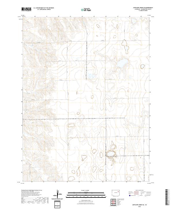
2022 Map of Antelope Creek SE
USGS Topo · Published 2022About this map
Antelope Cr defines the drainage pattern of this high plains landscape in eastern Washington County, flowing north through a series of shallow basins. The map illustrates a strictly regimented agricultural grid where the Public Land Survey System dictated every road and property line. This section of the Colorado plains is organized by a dense network of county roads, including north-south corridors like Co Rd X and Co Rd W, and east-west routes such as Co Rd 17 and Co Rd 15. The terrain is marked by seasonal wetlands and depressions, characteristic of the shortgrass prairie environment before it slopes toward larger river systems. Historically, these section-line roads served as the lifelines for homesteaders and dryland farmers, maintaining a spatial order that has remained largely unchanged for over a century.
Find a feature on this map
22 named features on this map. Tap any name to fly to it.
Don’t see what you’re looking for? This feature index may not catch every label — zoom into the map to look around manually.
Map Details
Editions of this 2022 Antelope Creek SE Map
This is the sole edition of this map. No revisions or reprints were ever made.
Other maps of this area

1954 · Limon
USGS Topo · 1:250,000

1957 · Limon
USGS Topo · 1:250,000

1958 · Limon
USGS Topo · 1:250,000

1973 · Antelope Creek East
USGS Topo · 1:24,000

1973 · Antelope Creek West
USGS Topo · 1:24,000

1973 · Dry Gulch
USGS Topo · 1:24,000

1973 · Lindon NE
USGS Topo · 1:24,000

1973 · Antelope Creek SE
USGS Topo · 1:24,000

1973 · Lindon
USGS Topo · 1:24,000
1974 · Elba
USGS Topo · 1:24,000