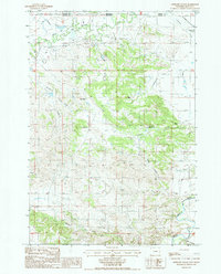
1984 Map of Antelope Gulch
USGS Topo · Published 1986About this map
The Little Missouri River meanders across this high plains borderland, where the boundary between Carter and Crook Counties marks the transition between Montana and Wyoming. This 1984 provisional survey illustrates a landscape of intermittent drainage and pastoral operations, characterized by ranching hubs such as Foster Ranch, Maupin Ranch, and Edsall Ranch. The terrain is defined by dramatic erosion features like Antelope Gulch and Heinbaugh Draw, while the broader drainage basin includes the Fourche River and North Boggy Creek. Small-scale industrial activity is evidenced by several Clay Pits near the river, and the engineering of the era is visible in the network of dikes and levees constructed to manage the unpredictable seasonal flow across the Stoneville Flats.
Find a feature on this map
24 named features on this map. Tap any name to fly to it.
Don’t see what you’re looking for? This feature index may not catch every label — zoom into the map to look around manually.
Map Details
Editions of this 1984 Antelope Gulch Map
2 editions found
Other maps of this area

1901 · Aladdin
USGS Topo · 1:125,000

1903 · Aladdin
USGS Topo · 1:125,000

1905 · Devils Tower
USGS Topo · 1:125,000

1954 · Ekalaka
USGS Topo · 1:250,000

1954 · Gillette
USGS Topo · 1:250,000

1955 · Gillette
USGS Topo · 1:250,000

1956 · Ekalaka
USGS Topo · 1:250,000

1957 · Mona
USGS Topo · 1:62,500

1957 · Seely
USGS Topo · 1:62,500

1958 · Gillette
USGS Topo · 1:250,000