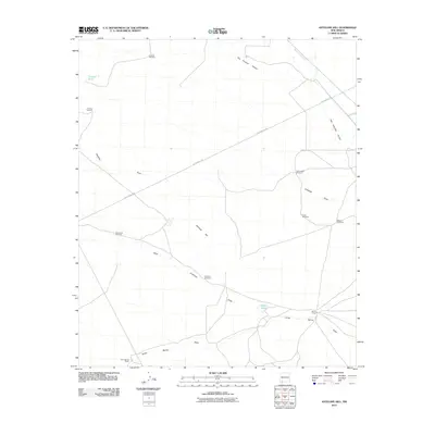
2010 Map of Antelope Hill
USGS Topo · Published 2010About this map
The Butterfield Trl cuts a historic diagonal across this Luna County landscape, tracing a path through the desert terrain south of Whitewater Creek. This 2010 survey highlights a region defined by water management and ranching, where numerous windmills and tanks support livestock in an arid environment. Landmarks such as the Butterfield Windmill, Chicken Windmill, and Munson Windmill are scattered throughout the draws, serving as vital markers for local navigation and land use.
Find a feature on this map
19 named features on this map. Tap any name to fly to it.
Don’t see what you’re looking for? This feature index may not catch every label — zoom into the map to look around manually.
Map Details
Editions of this 2010 Antelope Hill Map
This is the sole edition of this map. No revisions or reprints were ever made.
Other maps of this area

1899 · Deming
USGS Topo · 1:125,000

1909 · Silver City
USGS Topo · 1:125,000

1915 · Deming
USGS Topo · 1:125,000

1947 · Faywood Station
USGS Topo · 1:24,000

1949 · Whitewater
USGS Topo · 1:24,000

1949 · Faywood Station
USGS Topo · 1:24,000

1954 · Silver City
USGS Topo · 1:250,000

1955 · Las Cruces
USGS Topo · 1:250,000

1956 · Dwyer
USGS Topo · 1:62,500

1958 · Las Cruces
USGS Topo · 1:250,000