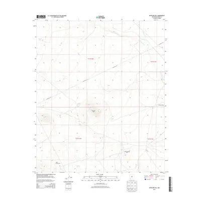
2013 Map of Antelope Hill
USGS Topo · Published 2013About this map
The Butterfield Trl cuts a historic diagonal path across this desert landscape, following a route famously used by the mid-19th-century overland mail stagecoach. This 2013 survey of the high-desert plains in Luna County reveals a terrain primarily defined by its drainage systems and water catchment points. Central to the map is Antelope Hill, a prominent rise that gives its name to the area and overlooks the nearby Antelope Draw and West Antelope Draw.
Find a feature on this map
13 named features on this map. Tap any name to fly to it.
Don’t see what you’re looking for? This feature index may not catch every label — zoom into the map to look around manually.
Map Details
Editions of this 2013 Antelope Hill Map
This is the sole edition of this map. No revisions or reprints were ever made.
Other maps of this area

1899 · Deming
USGS Topo · 1:125,000

1909 · Silver City
USGS Topo · 1:125,000

1915 · Deming
USGS Topo · 1:125,000

1947 · Faywood Station
USGS Topo · 1:24,000

1949 · Whitewater
USGS Topo · 1:24,000

1949 · Faywood Station
USGS Topo · 1:24,000

1954 · Silver City
USGS Topo · 1:250,000

1955 · Las Cruces
USGS Topo · 1:250,000

1956 · Dwyer
USGS Topo · 1:62,500

1958 · Las Cruces
USGS Topo · 1:250,000