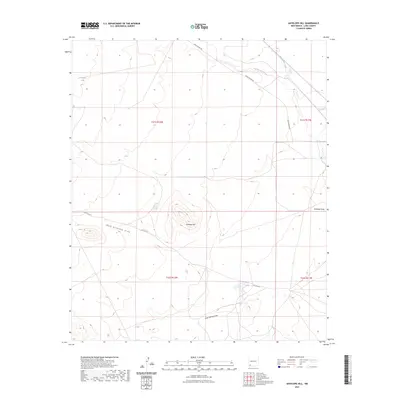
2023 Map of Antelope Hill
USGS Topo · Published 2023About this map
Antelope Hill rises as the central landmark in this high desert section of Luna County, where the arid landscape is defined by its seasonal water sources and deep drainage channels. Ranching infrastructure is evident through the placement of Criswell Tank in the northwest and Upton Tank to the southeast, strategically located to capture runoff in a territory where permanent water is scarce. The drainage pattern is complex, with San Vicente Arroyo and Whitewater Creek cutting through the northern reaches, while West Antelope Draw and Jones Spring Draw provide critical relief for the southern terrain. This modern survey illustrates how the grid of the Public Land Survey System, including t21s r12w and t21s r11w, overlays a land still primarily accessed by rural routes like Berta Moore Rd and Co Rd D017.
Find a feature on this map
14 named features on this map. Tap any name to fly to it.
Don’t see what you’re looking for? This feature index may not catch every label — zoom into the map to look around manually.
Map Details
Editions of this 2023 Antelope Hill Map
This is the sole edition of this map. No revisions or reprints were ever made.
Other maps of this area

1899 · Deming
USGS Topo · 1:125,000

1909 · Silver City
USGS Topo · 1:125,000

1915 · Deming
USGS Topo · 1:125,000

1947 · Faywood Station
USGS Topo · 1:24,000

1949 · Whitewater
USGS Topo · 1:24,000

1949 · Faywood Station
USGS Topo · 1:24,000

1954 · Silver City
USGS Topo · 1:250,000

1955 · Las Cruces
USGS Topo · 1:250,000

1956 · Dwyer
USGS Topo · 1:62,500

1958 · Las Cruces
USGS Topo · 1:250,000