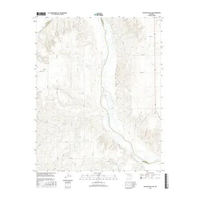
2016 Map of Antelope Hills NE
USGS Topo · Published 2016About this map
The Canadian River serves as the defining geographical boundary on this Oklahoma landscape, separating Ellis Co from Roger Mills Co. This segment of the river corridor is characterized by a high density of small-scale water management features, including the Johnson Reservoir, Frank McKram Reservoir, Bachman Reservoir, and Hanawalt Reservoir. These catchment areas are situated along the numerous tributaries that feed into the main river channel, such as Cottonwood Cr and Sand Cr. Cultural and genealogical interest centers on the Belleview Cem in the northwest, providing a point of historical continuity amidst the rural ranching and farming roads that crisscross the plains. The map illustrates a modern rural infrastructure where named section line roads like Pinkston Rd and D1800 Rd provide access across the rolling breaks leading down to the river valley.
Find a feature on this map
29 named features on this map. Tap any name to fly to it.
Don’t see what you’re looking for? This feature index may not catch every label — zoom into the map to look around manually.
Map Details
Editions of this 2016 Antelope Hills NE Map
This is the sole edition of this map. No revisions or reprints were ever made.
Other maps of this area

1955 · Clinton
USGS Topo · 1:250,000

1955 · Woodward
USGS Topo · 1:250,000

1957 · Clinton
USGS Topo · 1:250,000

1958 · Woodward
USGS Topo · 1:250,000

1965 · Roll NW
USGS Topo · 1:24,000

1965 · Crawford
USGS Topo · 1:24,000

1966 · Roll
USGS Topo · 1:24,000

1966 · Antelope Hills NE
USGS Topo · 1:24,000

1966 · Antelope Hills
USGS Topo · 1:24,000

1966 · Durham
USGS Topo · 1:24,000