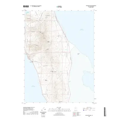
2020 Map of Antelope Island
USGS Topo · Published 2020About this map
Antelope Island rises from the Great Salt Lake in this 2020 topographic survey, revealing a landscape defined by isolated peaks and seasonal water sources. The map provides a detailed view of the island's central and northern ridges, including the prominent Frary Peak and Elephant Head. For those researching local history, the Frary Grave Site serves as a tangible connection to the early settlers of the island. The network of trails and primitive roads, such as the Buffalo Scaffold Trail and White Rock Loop Rd, suggests the modern transition of this terrain into a protected recreational space. Numerous natural springs, including Blackburn Spring and Dooly Spring, are charted along the slopes, highlighting the scarce but vital water resources that supported island life. Distinctive landmarks like Mollys Nipple and Picture Rock anchor the southern portion of the quadrangle near the shores of Farmington Bay.
Find a feature on this map
35 named features on this map. Tap any name to fly to it.
Don’t see what you’re looking for? This feature index may not catch every label — zoom into the map to look around manually.
Map Details
Editions of this 2020 Antelope Island Map
This is the sole edition of this map. No revisions or reprints were ever made.
Other maps of this area

1885 · Tooele Valley
USGS Topo · 1:250,000

1951 · Saltair
USGS Topo · 1:24,000

1952 · Saltair NE
USGS Topo · 1:24,000

1952 · Antelope Island South
USGS Topo · 1:24,000

1953 · Tooele
USGS Topo · 1:250,000

1954 · Antelope Island
USGS Topo · 1:24,000

1954 · Antelope Island North
USGS Topo · 1:24,000

1954 · Brigham City
USGS Topo · 1:250,000

1955 · Clearfield
USGS Topo · 1:24,000

1955 · Tooele
USGS Topo · 1:250,000